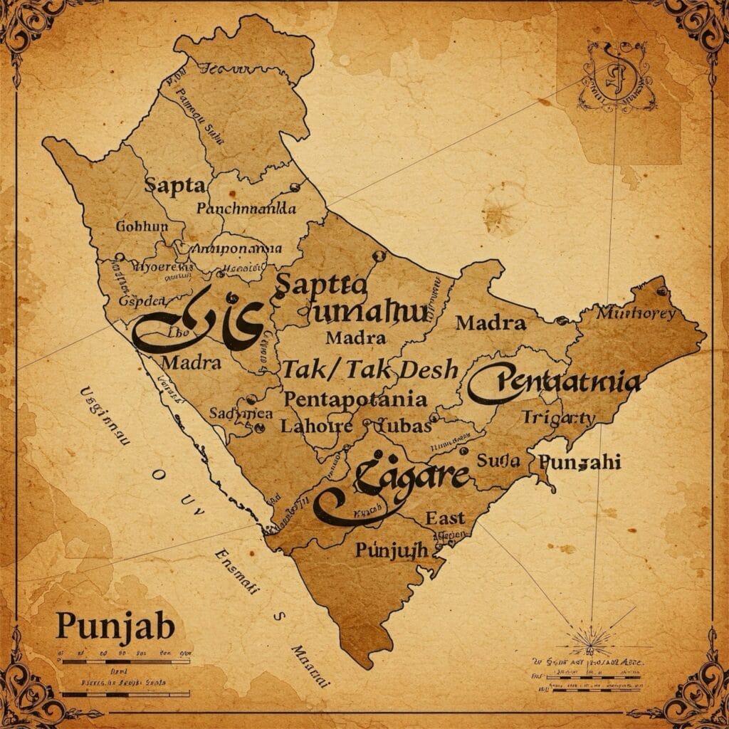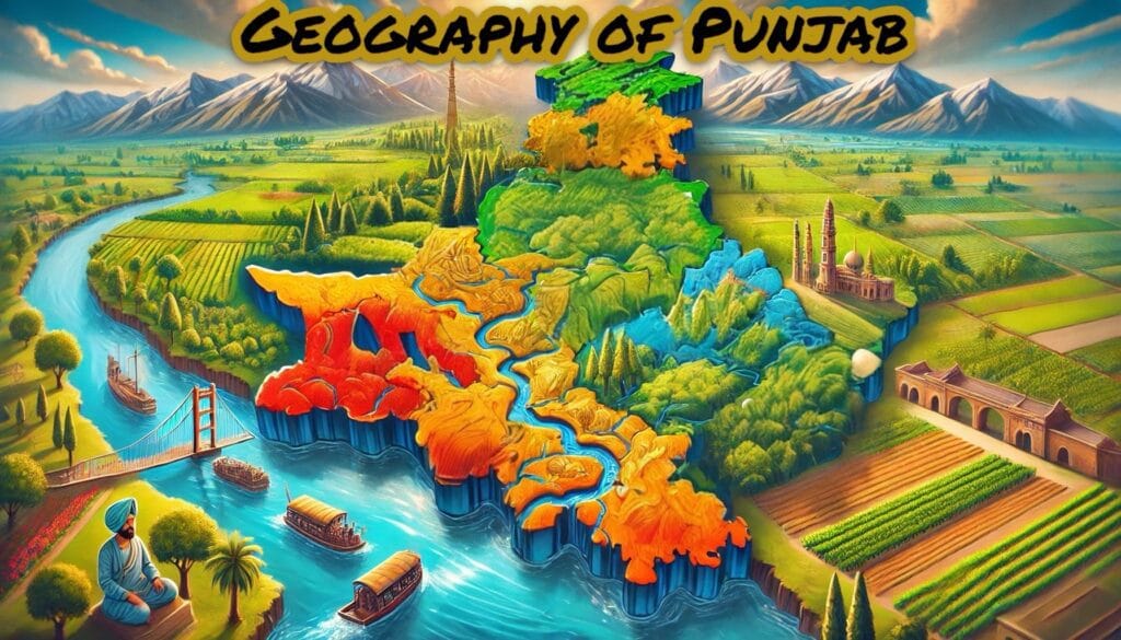
Punjab, one of the wealthiest states of India in terms of natural resources and economic prosperity, is situated in the northwestern part of the country. Physical features of Punjab, extends from 29° 30′ N to 32° 32′ N latitude and 73° 55′ E to 76° 50′ E longitude. The state spans approximately 335 km from Pathankot in the north to Mansa in the south and about 300 km from east to west.
As detailed in our previous article, “Names of Punjab Through Different Time Periods,” Punjab’s geographical characteristics have evolved over time. The state shares an international border with Pakistan, spanning 553 km across six districts. Additionally, it shares its boundaries with Himachal Pradesh to the east, Haryana and Rajasthan to the south . The newly created Union Territory of Jammu & Kashmir borders Punjab to the north, and Chandigarh, which is also the capital of Punjab, lies within its territorial limits.
Shaped like a triangle, Punjab forms the western segment of the Great Northern Plains, also known as the Satluj-Ganga Plains. Covering an area of 50,362 sq. km, Punjab accounts for 1.54% of India’s total geographical area and ranks 19th in size among the 28 Indian states. It is larger than Haryana, Kerala, Sikkim, Goa (India’s smallest state), and most northeastern states, except Arunachal Pradesh and Assam.
Physical Features of Punjab
Punjab boasts a fertile landscape, shaped by God’s own hand, making it one of the most agriculturally productive regions in the world. In the north, the Himalayan mountain range provides a natural barrier for Punjab, protecting Punjab from the cold Siberian winds and also enriches its soil through nutrient-rich silt deposits. The Hoshiarpur district, which has the highest forest cover in Punjab, is enhanced with its natural beauty, and along with this, it also produced poets like Bulleh Shah, Shah Hussain, and Bhai Gurdas Ji.
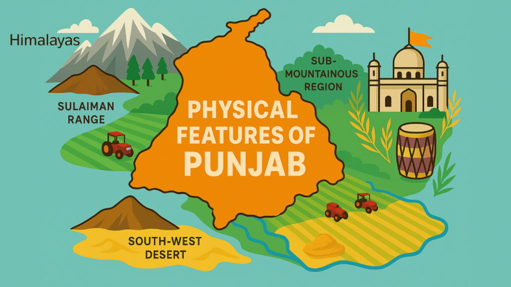
Punjab’s geographical features can be classified into three main regions:
- The Himalayas and the Sulaiman Mountain Ranges (now in Pakistan)
- The Sub-Mountainous Region
- The Plains
1. The Himalayas and the Sulaiman Mountain Ranges
(i) The Himalayas
The Himalayas, which has its literal meaning as “abode of snow,” stretch across 2,500 km starting from Assam in the east to Afghanistan in the west, with an approximate width of 240-320 km. These mountains are divided into three regions based on height.
- Great Himalayas (above 20,000 feet): The first one is the Great Himalayas which includes Mount Everest (Height is 29,032 ft or 8,848.86 m), the world’s highest peak. In recent days, studies have been conducted which revealed a slight increase in its height, which shows that Mount Everest, which is a fold mountain, is still growing and its height is increasing.
- Middle Himalayas (10,000-20,000 feet): Second one is Middle Himalayas which hosts popular hill stations like Shimla, Dalhousie, and Kashmir.
- Outer Himalayas (3,000-10,000 feet): The third and last one is Outer Himalayas which are also known as the Shivalik Range.
The Himalayas serve as a protective shield, preventing foreign invasions for centuries, ensuring adequate monsoon rainfall, and sustaining holy perennial rivers that enhance Punjab’s fertility.
(ii) Sulaiman Mountain Ranges (Now in Pakistan)
The Sulaiman Mountain Ranges, which are located in northwestern Punjab (which is now Pakistan), are strategically very significant due to their famous passes, including:
- Khyber Pass (most prominent)
- Bolan Pass
- Kurram Pass
- Tochi Pass
- Gomal Pass
These famous routes, historically and strategically, are very important as they facilitated trade and invasions from Afghanistan, Persia, and Turkey into Punjab.
2. The Sub-Mountainous Region
This hilly region lies between the Shivalik Range and Punjab’s plains, also known as Tarai. With elevations between 1,000 and 3,000 feet, it extends 5-12 km along Punjab’s northeastern border. Key districts in this region include Hoshiarpur, Pathankot, Nawanshahr, Rupnagar, parts of Gurdaspur, and Sialkot (Pakistan). Due to its less fertile soil, the population density here is relatively low.
(i) Kandi Region
The Kandi region, a degraded upland area, extends along the Pathankot-Hoshiarpur-Ropar-Chandigarh belt, with variations like:
This region is severy affected and divided with numer of choes (which are seasonal and ephemeral streams) and khads (sandy bed of streams). Because of rough, porous, and coarse-grained deposits, numerous choes disappear in the area without joining the major stream or river. It extends in the form of a narrow and long belt along the entire length of the Shiwalik Hills under different names—such as Kandi, Ghar, and Changar.
- Kandi
This region, located between 300 and 400 metres above sea level, serves as a transitional belt between the Shiwalik Hills and the Punjab plains. Characterized by rugged terrain and seasonal streams, the Kandi region plays a crucial role in groundwater recharge and ecological balance.
- Changar (Ropar District)
The Kandi area in Anandpur Sahib block of Ropar District is called as Changar. It is a strip of land extending along the left hand of river Satluj. It rises abruptly eastwards from Nangal-Ropar road.
- Ghar (Ropar District & Nurpur Bedi Block)
The dissected upland to the west of the Shiwalik Hills in Ropar district and to the south of the Sirsa Nadi is known as Ghar. This region, which is characterized by its rugged terrain along with seasonal streams, also faces significant soil erosion, which reduces the limited agricultural potential. The western part of Nurpur Bedi block, which is located to the east of the Shiwalik Hills, is also classified as the Ghar region. Despite its challenging landscape, this area plays a very crucial role in groundwater recharge of the region and also serves as a buffer zone between the plains and the mountainous regions.
This region is also characterized by seasonal streams (choes) and sandy riverbeds (khads), which also lead to soil erosion and limited agricultural potential in that region.
3. The Plains
The plains, which are the largest and the most fertile region of Punjab, lie between the Indus and Yamuna rivers at an elevation measured at less than 1,000 feet above sea level. Due to abundant rainfall and developed transport, this region has a high population density. It is further divided into:
(a) The Five Doabs
Derived from the Persian word “Doab” (meaning “land between two rivers”), the Mughal Emperor Akbar classified Punjab into five Doabs:
- Bist Jalandhar Doab (Beas & Sutlej Rivers) – Includes Jalandhar & Hoshiarpur
- Bari Doab (Beas & Ravi Rivers) – Known as Majha; includes Amritsar, Gurdaspur & Lahore (Pakistan)
- Rachna Doab (Ravi & Chenab Rivers) – Includes Gujranwala & Sheikhupura (Pakistan)
- Chaj Doab (Chenab & Jhelum Rivers) – Includes Gujarat & Shahpur (Pakistan)
- Sind Sagar Doab (Jhelum & Indus Rivers) – Includes Rawalpindi (Pakistan)
(b) Malwa and Bangar
This region, lying between Sutlej and Yamuna rivers, is further divided into:
- Malwa (Sutlej & Ghaggar Rivers): This area, located between the rivers Sutlej and Ghaggar, is called Malwa. The name of Malwa originates from the ancient Malwa tribe that once resided here in this region, which eventually led to the region being called Malwa, and its inhabitants are also referred to as Malwai. The main and famous cities of this Malwa region, as also discussed in our Punjabi Grammar section post, include Ludhiana, Patiala, Sirhind, Sangrur, Malerkotla, Bathinda, and Faridkot.
- The Bangar area, located between the rivers Ghaggar and Yamuna, is also known as Haryana. This region includes historically significant cities such as Ambala, Panipat, Rohtak, Karnal, Kurukshetra, Gurugram, Jind, and Hissar. The Bangar region, the very area which has seen many decisive battles in the history of India, includes the famous three battles of Panipat, which shaped our Indian subcontinent map.
(c) South-West Desert or Dune Studded Region
South-West Desert or Dune Studded Region, which is also the semi-arid region and borders the Thar Desert of Rajasthan, covers Bathinda, Faridkot, Ferozepur, Mansa, Muktsar, and Sangrur. The sand dunes and ridges of this region, formed due to the actions of the Sutlej and Ghaggar rivers, are locally called “Tibbas.”
Punjab’s rich geography has shaped Punjab’s history, agriculture, and culture. If you see, from Himalayan peaks to fertile plains, each of these regions plays a very crucial role in its prosperity. So, understanding Punjab’s physical features provides valuable knowledge for competitive exams like PSSSB, PCS, Punjab Patwari, and Punjab Police.
FAQs
1. What is the latitude and longitude of Punjab (India)?
Latitude and Longitude of Punjab: Punjab is located in the northwestern part of India, lying between 29°30′N to 32°32′N latitude and 73°55′E to 76°50′E longitude.
2. How many states and countries share border with Punjab?
Punjab shares its border with 3 states—Himachal Pradesh, Haryana, and Rajasthan—along with 2 Union Territories, Chandigarh and Jammu & Kashmir, and shares a border with the country Pakistan (553 km).
3. What is the Kandi region of Punjab?
The Kandi region of Punjab is a narrow, long belt region along the Shivalik Hills, which are also known by different names in different regions, such as Changar in Anandpur Sahib and Ghar in parts of Ropar district.
4. What are the 5 Doabs of Punjab?
5 Doabs of Punjab, which are historically divided and named after the rivers between them:
Bist Jalandhar Doab (Beas-Sutlej)
Bari Doab (Beas-Ravi)
Rachna Doab (Ravi-Chenab)
Chaj Doab (Chenab-Jhelum)
Sind Sagar Doab (Jhelum-Indus)
5. What region is the Malwa of Punjab?
The Malwa region, which lies between the Sutlej and Ghaggar rivers, is typically named after the Malwa tribe of the region. The major cities in the Malwa region include Ludhiana, Patiala, and Bathinda.
6. What is the Bangar region of Punjab?
The Bangar region, which in modern times is also known as Haryana, lies between the Ghaggar River and the Yamuna River. This region was the very site of important battles, including the three battles of Panipat.