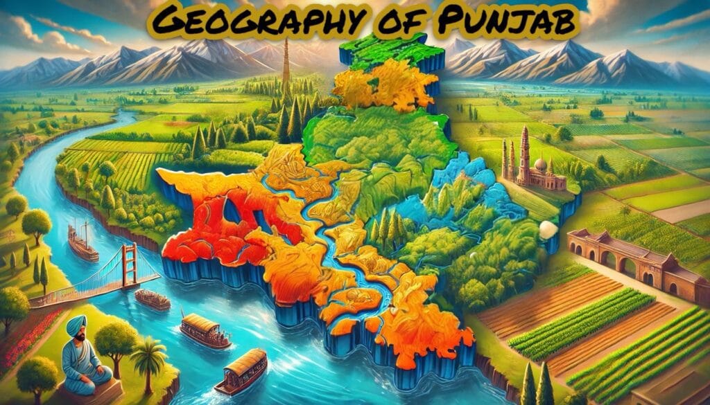
Punjab, which is often called the “Land of Five Rivers,” has its name coined from the rivers and has a rich history of river systems. The rivers of Punjab not only make the map of Punjab but also shape the geography and culture of this very region. They also play a very crucial role in the agricultural development of the region. So, if you are preparing for competitive exams, especially for the PSSSB, Punjab Police, SSC, Excise Inspector, PPSC, UPSC, etc., these rivers of Punjab become essential and most important because understanding these rivers is crucial.
The Seven Sindhus: Ancient References to Punjab’s Rivers
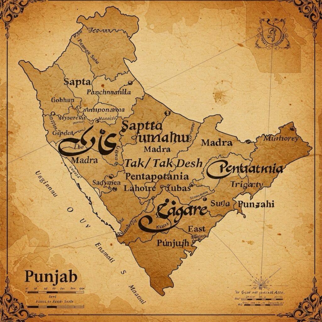
In the ancient texts of India, e.g., the Rigveda, Punjab was the land that was watered by or surrounded by “Seven Sindhus,” which literally means the seven rivers. These seven are the Indus and its five tributaries (Satluj, Beas, Ravi, Chenab, and Jhelum), and the seventh one, the Sarasvati River. In the Mahabharata, the epic of ancient India, it is further elaborated in the text that this region of Punjab was also known as Panchanada. At this time, this means the Land of Five Rivers, excluding the Indus River and the Sarasvati River. Similarly, the Greeks also called it “Pentapotamia,” which again means the Land of Five Rivers.
But in modern times, after the partition of India in 1947, Punjab was divided into two, and along with this, Punjab was left with three perennial rivers—Sutluj, Beas, and Ravi. The remaining two, Chenab and Jhelum, went to Pakistani Punjab.
Types of Rivers of Punjab
Punjab’s rivers can be classified into two categories:
- Perennial Rivers : These rivers of Punjab flow throughout the year.
- Seasonal or Ephemeral Rivers : These rivers of Punjab flow only during the monsoon season.
Perennial Rivers of Punjab
1. The Satluj River

Ancient Names and Origin
The Satluj River, also called in ancient times Sutudri (in Sanskrit) and Hesidros/Zaradros (in Greek), is a major river of Punjab. This Sutlej River originates from the Rakas Lake, which is located near the Mansarovar Lake in Tibet, and has an elevation of 4,555 meters above sea level. In Tibet, it is also called by another local name, Langchen Khambab, which literally translates to “River of Glaciers.” The river flows along the southern slopes of the Kailash Parbat (also known locally as Gang Tise), and then the Satluj River embarks on its long journey through rugged terrains and fertile plains.
The Course of the River
After flowing through Tibet, the Sutlej enters India through the Shipki La Pass in Himachal Pradesh, which is shown in the above image. Then the Satluj flows its way into the heart of the Himalayas. Then it gracefully meanders through the picturesque districts of Kinnaur in Himachal Pradesh, where it flows past beautiful apple orchards and snow-capped mountain peaks, before entering the scenic Kanwar Valley in Kullu district of Himachal Pradesh. Continuing its south-westerly course, the river arrives at the iconic towns of Himachal Pradesh such as Shimla, Mandi, Solan, and Bilaspur.
Another important and one of the most remarkable features of the Satluj River is its passage through the Gobind Sagar Reservoir, a reservoir created with the Bhakra-Nangal Project. As the river enters Punjab near Nangal in Ropar district of Punjab, here lies one of India’s oldest dams, the Bhakra-Nangal Dam. It is also one of the largest gravity dams in the world, constructed between 1949 and 1963.
The Satluj, which flows approximately 160 kilometers downstream from Ropar, virtually divides Punjab into two parts and finally merges with the Beas River at Harike in Tarn Taran District. Afterwards, the confluence of these with the other three rivers—the Ravi, the Chenab, and the Jhelum—flows to Pakistan and joins with the Indus River, which makes this Panjnad (Five Rivers).
International Significance
The Satluj, which originates in the Rakas Lake near the Mansarovar Lake in Tibet, a lake that is also the source for other rivers, carved its path over this land for millions of years. Along with this, the River Sutlej also forms the international boundary between India and Pakistan for about 120 kilometers, stretching from near Ferozpur to Fazilka. As mentioned earlier, the Sutlej River separates Punjab into two distinct regions: Northern Punjab and Southern Punjab. With this, it also makes Punjab culturally and geographically unique.
Tributaries and Towns Along Its Banks
The Satluj River, which covers and flows through a vast portion of the land from Tibet to Pakistan, has the majority of its course in India, especially in Punjab. It also has several tributaries, including the Baspa, Spiti, Soan, and Nagli Khad. In Himachal Pradesh, cities like Bilaspur, Rampur, Kumharsain, Taranda, Kalpa, and Namgaya are important cities on the banks of the Satluj River. Similarly, in Punjab, towns such as Ropar, Phillaur, Harike, and Ferozpur are important cities.
Dams and Engineering Marvels
As the Satluj makes Punjab and other regions flourish with agriculture, it has also been significantly used for both energy and irrigation purposes through several projects. Important among them are the Nathpa Jhakri Dam, the Karcham Wangtoo Hydroelectric Plant, and the nationally important Bhakra-Nangal Dam.
Length and Legacy
The total stretch of the Satluj River is approximately 1,450 to 1,500 kilometers, and it flows through Punjab for about 160 kilometers, making it the longest river of Punjab. Along with its Sanskrit and Greek names, it is also called the Red River of Punjab, along with the Brahmaputra, which is also known as the Red River of India because of the reddish hue it gets from the silt-laden water during the monsoon season.
From its glacial origination in Tibet to its final merging with the Panjnad in Pakistan, the Satluj River shows the story of interconnection of different regions, cultures, and habitats. The river not only has the significance of flowing across vast lengths through countries, but it also creates Punjab’s map into two different regions and nurtures its waters to generate energy for the people of Punjab.
2. The Beas River

Origins in the Himalayas
The Beas River, also known as Vipasha in Sanskrit and Hyphasis in Greek, originates from the Beas Kund near Rohtang Pass in the Kullu hills of Himachal Pradesh. The total elevation is 4,000 meters above sea level, and it is surrounded by snow-clad mountain peaks. The river begins its journey as a small stream in Himachal Pradesh, carving out its path as it makes its way to Punjab.
The Course of the River
The course of the Beas River through the Kullu Valley flows through apple orchards, pine forests, and quaint villages. As the river flows downward, it cuts the Dhauladhar Range in a gorge near Kati and Largi, which makes the area more scenic and beautiful.
With the continuation downstream, the Beas River enters the Kangra Valley, where it nourishes the fields and supports the area there. Then it enters Punjab from Talwara town in the Hoshiarpur district, where the river is joined by a number of small streams and rivulets, which are locally called choes and khads. Afterwards, near Mirthal town, it merges with the Chakki stream, which adds a huge volume to it.
Again, continuing its course in the south-western direction, the Beas flows through the districts of Kapurthala and Amritsar and then finally meets its confluence with the Satluj River at Harike in the Tarn Taran district. With this, it ends the total 460 km long journey of the Beas River, which during its course shapes the areas, the people, and their culture.
Significance of the Beas
If we look at the significance of the Beas River, it has infinite impact on the economy and ecology. Among them is the Pong Dam, also known as the Maharana Pratap Sagar (which was constructed between 1961 and 1975). This Pong Dam, which is multipurpose in use, serves as a vital source of hydroelectric power and is also used for irrigation, which supports agriculture locally. Additionally, the Upper Bari Doab Canal system also draws water from the Beas and enriches the land there with prosperity.
Tributaries
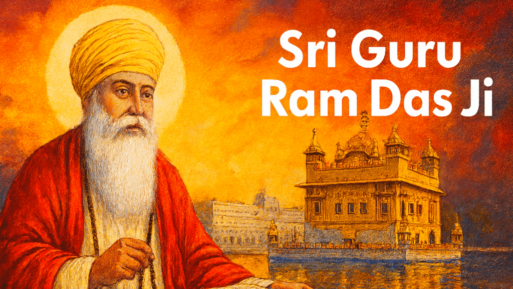
The Beas River has several tributaries that give it strength and make it more significant. On its left bank, the Parbati and Suketi rivers join the Beas course, and at the same time, on the right, the Uhl, Lambadung, Gaj, and Chakki contribute their waters to the Beas. Among these tributaries, the Parbati has special importance as it is revered as a sacred river by Sikh pilgrims, and the Manikaran Gurdwara is located on its bank. The significance is that the gurdwara is famous for its hot springs and spiritual aura, and it was once visited by Shri Guru Nanak Dev Ji.
Length and Legacy
The total length of the Beas River is 460 kilometers, which makes this river the second longest river of Punjab. It has been most important for civilization in Himachal Pradesh and Punjab, supporting the region’s agriculture, trade, and community for centuries.
Towns Along Its Banks
In the course of the Beas River, there are a number of towns and cities, each influenced by its waters. Specifically, in Himachal Pradesh, the towns are Mandi, Nagar, Kullu, and Manali, and in Punjab, the famous towns and cities are Talwara, Mirthal, and Harike. Harike is the crucial meeting point of the Satluj and Beas, where the Beas ends its course and merges with the Satluj.
3. The Ravi River

Origins
The Ravi River, one of the five sacred rivers of Punjab, originates from the western slope of the Rohtang Pass in the Kullu Hills of Himachal Pradesh. The elevation of the Ravi River is about 4,100 meters above sea level, and it begins its journey by draining the western slopes of the Pir Panjal Range and passing through the slopes of the Dhauladhar Range in Himachal Pradesh, carving its path through the beautiful landscape of the Himalayas.
The Course of the River
The course of the Ravi River passes through the Chamba Valley, as the River Ravi enriches the region with the silt it carries along with it. The Chamba Valley, known for its greenery and ancient temples, owes much of its charm to the nurturing of the area. After flowing through the course of the Chamba Valley of Himachal Pradesh, the Ravi River enters Punjab near Chaundh village on the border of Chamba in Himachal Pradesh, towards Pathankot.
In Punjab, the river flows through the districts of Pathankot , Gurdaspur , and Amritsar , bringing life to the fertile plains. It eventually crosses into Pakistan, where it merges with the combined course of the Jhelum and Chenab rivers near Sarai Sidhu , close to Rangpur. With this whole journey, the Ravi River eventually covers a distance of about 720 kilometers in total, which makes it Punjab’s third largest river in terms of length.
Significance of the Ravi
The Ravi River has the most significance in the region and has also played a vital role in shaping the agricultural and economic landscape of the area. With this important significance of the Ravi river, the then Indian government had constructed two major dams on the Ravi River which are both statrigically important and also to utilize its full potential along with its water:
- Ranjit Sagar Dam (Thein Dam): The Ranjit Sagar Dam, also known as the Thein Dam, is located at the town of Jugial near Pathankot city. The Ranjit Sagar Dam, which is also a multipurpose dam, was constructed for irrigation and hydroelectric power generation. It supports in many ways, one of them being the agricultural prosperity of northern Punjab, and along with this, it also provides electricity to the people of both the states of Jammu & Kashmir and Punjab.
- Chamera Dam: Chamera Dam, which is again a very important dam for the national or the Himachal Pradesh government, is located in the Chamba Valley of Himachal Pradesh. This dam has been contributing significantly to hydroelectric generation for Himachal Pradesh, greatly enhancing the resources of the state.
Tributaries of Ravi River
As the River Ravi flows through Himachal Pradesh to Punjab and then ends up in Pakistan, it has several tributaries. On its left bank, the Ujh and Jalalia Nadi join the River Ravi, and on the right bank, the Budhil, Basantar, and Sakki Kiran Nala drain their waters into the River Ravi. The tributaries not only increase the volume of water in the Ravi but also create diverse ecosystems along its course, which eventually help support agriculture, wildlife, and especially humans.
Length
As earlier mentioned, the total length which the Ravi River covers is about 720 kilometers, which makes this river the third largest river of Punjab. The Ravi River supports the communities of Himachal Pradesh, Punjab, and other regions, while also enhancing the agriculture, trade, and culture of the region.
Towns Along Its Banks
The Ravi River has nurtured many regions and cities along its course, as it brings important silt and water. The important towns or cities along the Ravi River are: in Himachal Pradesh, the Chamba Valley, which is a very important and historical town famous for its ancient temples and scenic beauty. In Punjab, towns like Pathankot, Gurdaspur, and Amritsar are the important towns or cities that are beneficiaries of the Ravi River.
Seasonal River Ephemeral Rivers of Punjab
The Ghaggar River: A Glimpse into the Past
Origins and Course
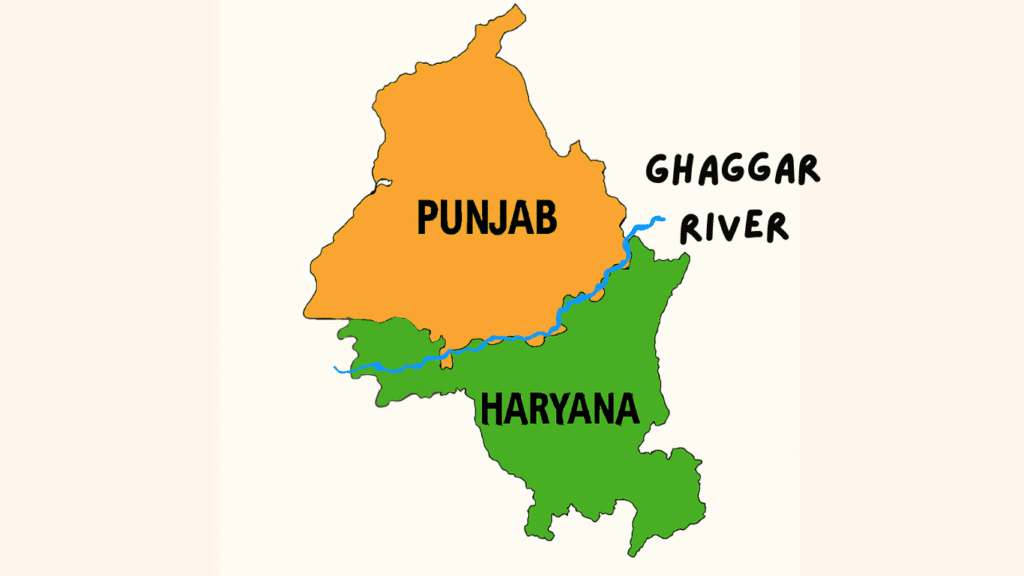
The Ghaggar River , a seasonal river that awakens during the monsoon season, originates in the lower slopes of the Himalayas near the Saharan area in the Sirmaur district of Himachal Pradesh. Flowing through the picturesque Pinjore and Morni Hills of Haryana, it carves its way through the rugged terrain, leaving the hills via the Chandigarh Gorge .
As it enters the plains, the Ghaggar meanders through the southern parts of Punjab, passing through districts like Patiala , Sangrur , and Mansa in a south-westerly direction. Beyond this point, the river is known as Harike , which eventually disappears into the sands near Hanumangarh in the Ganganagar district of Rajasthan.
A River Steeped in Mystery
The Ghaggar River has long fascinated historians, geologists, and archaeologists due to its unique characteristics. The riverbed, which spans an impressive width of 5 to 8 kilometers in some areas, is composed of loamy soil, suggesting that it once carried vast quantities of water.
It is also thought that the Ghaggar once received water from two rivers: the Satluj from the northeast side and the Yamuna from the eastern side. However, with the span of time and mainly due to significant physiographic, climatic, and tectonic changes, the course of these rivers shifted. The Satluj moved northwestward, and the Yamuna turned southeastward, which significantly left the Ghaggar deprived of its primary sources of water from these rivers. As a result, the Ghaggar River, which was once called a mighty river, has now been transformed into a seasonal stream, flowing only during the monsoon season once a year.
The Lost Saraswati Connection
The River Ghaggar, which is also identified as the Saraswati River by archaeologists, was mentioned in the ancient Rigvedic text. According to the Rigveda, the Saraswati is believed to have followed the same course as the Ghaggar River. Archaeological findings along the Ghaggar River, including remnants of the Indus Valley Civilization and their artifacts, provide strong evidence supporting the theory that the Saraswati River once flowed through the same course as the Ghaggar River.
So after the drying and seasonal flowing of the Ghaggar River, the Indus Valley Civilization significantly declined, because with the water of the Ghaggar many important cities thrived on this river, as many other important sites were located along the Saraswati River banks. The most important cities like Kalibangan and Banawali depended on the fertile lands nourished by the river, but as its waters began to recede, these civilizations gradually declined in history.
Significance Today
Though the Ghaggar River in modern times is a seasonal river, it continues to hold its cultural and historical significance as in ancient times. During the monsoon season, the River Ghaggar provides water for the fields of Punjab, Haryana, and Rajasthan. However, the uncontrolled flow of the river many times floods the fields, often destroying the crops. The river also depends only on rainfall, which makes it less reliable compared to other perennial rivers like the Ravi, Satluj, and Beas.
The Rivers of Punjab
Punjab, which is also known as the Land of Five Rivers, has five rivers: Satluj, Beas, Ravi, Chenab, and Jhelum, and another one, the seasonal Ghaggar, which have shaped the geography of Punjab and also its economy and identity over time. From the origins of these rivers in the Himalayas to depositing mineral‑rich silt in the fields of Punjab’s fertile plains and eventually ending up in the confluence of the Indus River.
The rivers like Satluj, Beas, and Ravi, which flow throughout the year and are also called perennial rivers, have a positive impact on Punjab’s agricultural prosperity. Along with this, they also have a major impact on the economy of Punjab, Jammu and Kashmir, and Himachal Pradesh through the construction of dams that produce hydroelectric projects. Meanwhile, the ephemeral river like the Ghaggar, which flows only in the monsoon season and is also believed to be the ancient Saraswati, has impacted Punjab’s Malwa region by helping to recharge its water level and influencing soil nourishment.