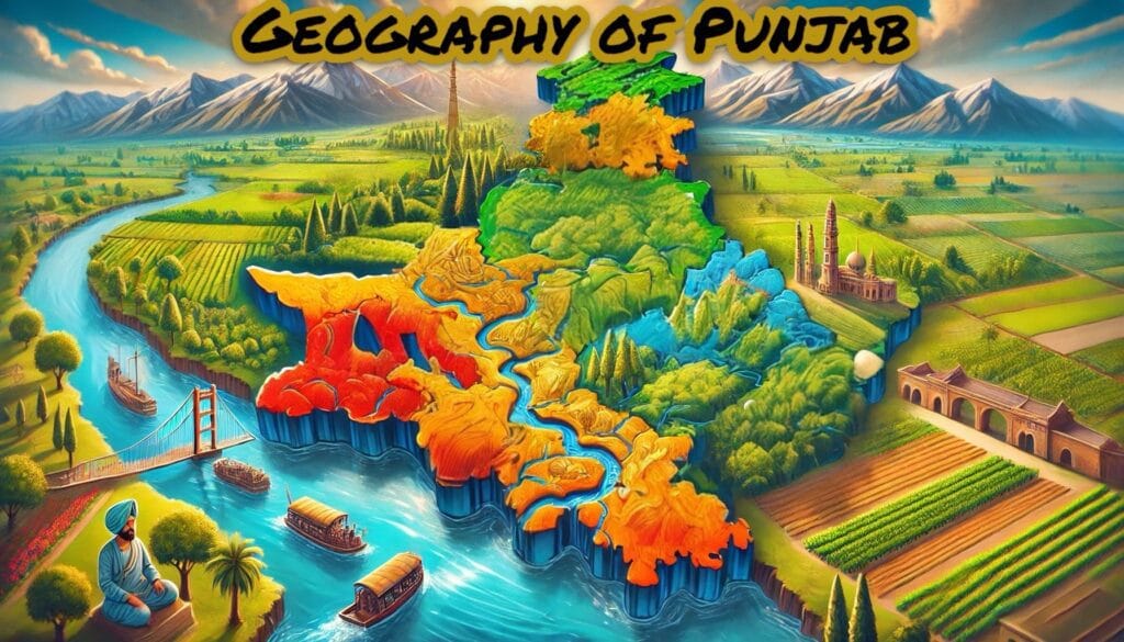
Punjab, often referred to as the “Land of Five Rivers,” has a rich history deeply intertwined with its river systems. These rivers of Punjab have not only shaped the geography and culture of the region but also played a pivotal role in its agricultural prosperity. For aspirants preparing for competitive exams like PSSSB, Senior Assistant, Labour Inspector, PCS, Excise Inspector, Patwari, and others, understanding the rivers of Punjab is crucial. This article delves into the origins, courses, tributaries, and historical significance of Punjab’s mighty rivers.
Table of Contents
The Seven Sindhus: Ancient References to Punjab’s Rivers
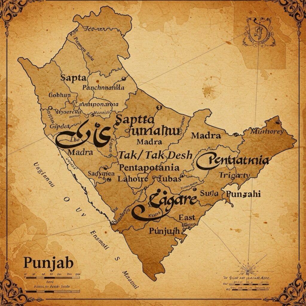
In ancient texts like the Rigveda, Punjab was known as the land watered by the “Seven Sindhus.” These seven rivers are believed to include the Indus, its five tributaries (Satluj, Beas, Ravi, Chenab, and Jhelum), and the mythical Sarasvati River. The Mahabharata further elaborates on this, referring to Punjab as “Panchanada,” meaning “Land of Five Rivers.” Similarly, the Greeks called it “Pentapotamia,” which translates to “the country of five rivers.”
After the partition of India in 1947, Punjab was left with three perennial rivers—Satluj, Beas, and Ravi—while the remaining two, Chenab and Jhelum, now flow through Pakistan.
Types of Rivers of Punjab
Punjab’s rivers can be classified into two categories:
- Perennial Rivers : These rivers of Punjab flow throughout the year.
- Seasonal or Ephemeral Rivers : These rivers of Punjab flow only during the monsoon season.
Perennial Rivers of Punjab
1. The Satluj River: A Journey Through Time and Terrain

Ancient Names and Origins
The Satluj River, known in ancient times as Sutudri (in Sanskrit) and Hesidros/Zaradros (in Greek), is a lifeline of northern India. This majestic river originates from the pristine Rakas Lake , located near the sacred Mansarovar Lake in Tibet, at an elevation of 4,555 meters above sea level. In Tibet, it is fondly called Langchen Khambab , which translates to “River of Glaciers.” Flowing along the southern slopes of the revered Kailash Parbat (known locally as Gang Tise), the Satluj embarks on its long journey through rugged terrains and fertile plains.
The Course of the River
Entering India through the historic Shipki La Pass in Himachal Pradesh, the Satluj carves its way into the heart of the Himalayas. It gracefully meanders through the picturesque districts of Kinnaur , where it flows past apple orchards and snow-capped peaks, before entering the scenic Kanwar Valley in Kullu district. Continuing its south-westerly course, the river touches iconic towns such as Shimla , Mandi , Solan , and Bilaspur , enriching these regions with its waters.
One of the most remarkable features of the Satluj’s journey is its passage through the mighty Gobind Sagar Reservoir , a reservoir created by the Bhakra-Nangal Project. As the river exits Himachal Pradesh, it enters Punjab near Nangal in Ropar district. Here lies the colossal Bhakra-Nangal Dam , one of the largest gravity dams in the world, constructed between 1949 and 1963. This engineering marvel not only generates hydroelectric power but also supports extensive irrigation systems that sustain Punjab’s agricultural prosperity.
Approximately 160 kilometers downstream from Ropar, the Satluj merges with the Beas River at Harike in Tarn Taran district. Together, they flow towards the confluence of three other mighty rivers—the Ravi , Chenab , and Jhelum —forming the celebrated Panjnad (“Five Rivers”). This union marks the culmination of Punjab’s legendary five rivers, symbolizing unity and abundance.
International Significance
As an antecedent river, the Satluj predates the formation of the Himalayan mountain range, carving its path over millions of years. For about 120 kilometers, it forms the international boundary between India and Pakistan, stretching from near Ferozpur to Fazilka . This natural divide roughly separates Punjab into two distinct regions: Northern Punjab and Southern Punjab , each with its unique cultural and geographical identity.
Tributaries and Towns Along Its Banks
The Satluj is nourished by several tributaries, including the Baspa , Spiti , Soan , and Nogli Khad , which contribute to its strength and vitality. Numerous towns have flourished along its banks, drawing sustenance from its life-giving waters. In Himachal Pradesh, cities like Bilaspur , Rampur , Kumharsain , Taranda , Kalpa , and Namgaya owe their existence to the river. Similarly, in Punjab, towns such as Ropar , Phillaur , Harike , and Ferozepur thrive under its benevolent influence.
Dams and Engineering Marvels
The Satluj has been harnessed for both energy and irrigation through several monumental projects. Key among them are the Nathpa Jhakri Dam , the Karcham Wangtoo Hydroelectric Plant , and the aforementioned Bhakra-Nangal Dam . These structures stand as testaments to human ingenuity and the river’s immense potential.
Length and Legacy
Stretching approximately 1,450–1,500 kilometers , the Satluj is more than just a river; it is a symbol of resilience and continuity. Often referred to as the Red River of Punjab , it shares this poetic title with the Brahmaputra, which is known as the Red River of India . The name reflects the reddish hue of its silt-laden waters during the monsoon season, painting a vivid picture of nature’s raw beauty.
From its glacial origins in Tibet to its eventual merging with the Panjnad, the Satluj River tells a story of endurance, transformation, and interconnectedness. It is not merely a waterway but a living entity that binds communities, fuels economies, and shapes landscapes. Whether you’re marveling at its cascading rapids in Himachal Pradesh or witnessing its serene flow through Punjab’s golden fields, the Satluj invites you to explore its timeless charm and profound significance.
2. The Beas River: A Journey Through the Heart of Himachal and Punjab

Origins in the Himalayas
The Beas River , a lifeline of northern India, originates from the sacred Beas Kund , nestled near the breathtaking Rohtang Pass in the Kullu Hills of Himachal Pradesh. At an elevation of 4,000 meters above sea level, this pristine source is surrounded by snow-clad peaks and lush meadows. The river begins its journey as a small stream but quickly grows into a mighty force, carving its path through some of the most picturesque landscapes in the Himalayas.
The Course of the River
Flowing through the enchanting Kullu Valley , the Beas weaves its way past apple orchards, pine forests, and quaint villages. As it descends, the river cuts through the rugged Dhauladhar Range in a dramatic gorge near Kati and Largi , showcasing nature’s raw power. This section of its course is a paradise for adventurers, offering thrilling opportunities for white-water rafting amidst stunning scenery.
Further downstream, the Beas enters the fertile Kangra Valley , where it nourishes verdant fields and supports thriving communities. Crossing into Punjab near Talwara in the Hoshiarpur district, the river is joined by numerous smaller streams and rivulets known locally as choes and khads , enriching its flow. Near Mirthal , the Chakki Stream merges with the Beas, adding to its volume and vitality.
Continuing its south-westerly journey, the Beas flows through the districts of Kapurthala and Amritsar , before finally meeting its confluence with the Satluj River at Harike in Tarn Taran district. This union marks the end of the Beas’s 460-kilometer-long odyssey, during which it has shaped landscapes, sustained life, and inspired countless generations.
Significance of the Beas
The Beas plays a pivotal role in the region’s economy and ecology. One of its most notable contributions is the Pong Dam , also known as the Maharana Pratap Sagar (constructed between 1961 and 1975). This multipurpose dam serves as a vital source of hydroelectric power and irrigation, supporting agriculture across vast swathes of land. Additionally, the Upper Bari Doab Canal System draws water from the Beas, ensuring the prosperity of Punjab’s famed “Granary of India.”
Tributaries That Enrich Its Flow
The Beas is fed by several tributaries that enhance its strength and significance. On its left bank, the Parbati and Suketi rivers join its course, while on the right, the Uhl , Lambadung , Gaj , and Chakki contribute their waters. Among these, the Parbati holds special cultural importance, as the revered Manikaran Gurdwara —a significant Sikh pilgrimage site—is located on its banks. This gurdwara is renowned for its hot springs and spiritual aura, attracting devotees from all over the world.
Length and Legacy
Stretching approximately 460 kilometers , the Beas may not be the longest river in the region, but its impact is profound. It has been a cornerstone of civilization in Himachal Pradesh and Punjab, fostering agriculture, trade, and culture for centuries.
Towns Along Its Banks
The Beas River has nurtured numerous towns and cities along its course, each bearing testimony to its enduring influence. In Himachal Pradesh, towns like Mandi , Nagar , Kullu , and Manali owe much of their charm and prosperity to the river. These destinations are popular among tourists for their natural beauty, adventure sports, and spiritual significance. In Punjab, the town of Harike stands out as a critical point where the Beas meets the Satluj, creating a vibrant ecosystem that supports diverse flora and fauna.
A River of Life and Legend
The Beas is more than just a river; it is a symbol of life, resilience, and unity. From its glacial origins in the Himalayas to its confluence with the Satluj, it tells a story of transformation and interconnectedness. Whether you’re marveling at its roaring rapids in Kullu or basking in the tranquility of its waters near Harike, the Beas invites you to witness its timeless beauty and profound legacy.
This river, steeped in history and brimming with natural splendor, continues to shape the lives of millions, reminding us of the delicate balance between humanity and nature.
3. The Ravi River: A Lifeline of the Himalayas and Punjab

Origins in the Majestic Himalayas
The Ravi River , one of the five sacred rivers of Punjab, originates from the western slopes of the Rohtang Pass in the Kullu Hills of Himachal Pradesh. At an elevation of 4,100 meters above sea level, this pristine river begins its journey amidst snow-capped peaks and alpine meadows. Draining the western slopes of the Pir Panjal Range and the northern slopes of the Dhauladhar Range , the Ravi carves its path through some of the most breathtaking landscapes in the Himalayas.
The Course of the River
Flowing gracefully through the picturesque Chamba Valley , the Ravi enriches the region with its fertile waters. The valley, known for its lush greenery and ancient temples, owes much of its charm to the river’s nurturing presence. After winding its way through Chamba, the Ravi enters Punjab near Chaundh Village on the Chamba border.
In Punjab, the river flows through the districts of Pathankot , Gurdaspur , and Amritsar , bringing life to the fertile plains. It eventually crosses into Pakistan, where it merges with the combined course of the Jhelum and Chenab rivers near Sarai Sidhu , close to Rangpur . This confluence marks the culmination of the Ravi’s journey, which spans approximately 720 kilometers .
Significance of the Ravi
The Ravi has played a crucial role in shaping the agricultural and economic landscape of the region. Two major dams have been constructed on the river to harness its potential:
- Ranjit Sagar Dam (Thein Dam) : Located near Pathankot, this multipurpose dam is a marvel of modern engineering. Constructed primarily for irrigation and hydroelectric power generation, it supports the agricultural prosperity of Punjab and provides electricity to millions.
- Chamera Dam : Situated in the Chamba Valley of Himachal Pradesh, this dam is another significant contributor to hydroelectric power generation, further enhancing the region’s energy resources.
These projects highlight the Ravi’s importance as a source of renewable energy and sustainable development.
Tributaries That Enrich Its Flow
The Ravi is nourished by several tributaries that enhance its strength and vitality. On its left bank, the Ujh and Jalalia Nadi join its flow, while on the right, the Budhil , Basantar , and Sakki Kiran Nala contribute their waters. These tributaries not only increase the river’s volume but also create diverse ecosystems along its course, supporting agriculture, wildlife, and human settlements.
Length and Legacy
Stretching approximately 720 kilometers , the Ravi may not be the longest river in the region, but its impact is profound. For centuries, it has been a lifeline for communities in Himachal Pradesh and Punjab, fostering agriculture, trade, and culture. Its waters have irrigated fields, powered industries, and inspired poets and artists, making it an integral part of the region’s identity.
Towns Along Its Banks
The Ravi River has nurtured numerous towns and cities along its course, each bearing testimony to its enduring influence. In Himachal Pradesh, the Chamba Valley stands out as a cultural and historical gem, with its ancient temples and scenic beauty. In Punjab, towns like Pathankot , Gurdaspur , and Amritsar thrive under the river’s benevolent influence.
Pathankot, located at the foothills of the Himalayas, serves as a gateway to the region and benefits immensely from the river’s resources. Gurdaspur and Amritsar, both vibrant hubs of culture and commerce, owe much of their prosperity to the Ravi’s fertile waters.
A River of History and Harmony
The Ravi is more than just a river; it is a symbol of unity, resilience, and cultural heritage. From its glacial origins in the Himalayas to its confluence with the Jhelum and Chenab in Pakistan, it tells a story of interconnectedness and shared history.
For centuries, the Ravi has witnessed the rise and fall of empires, the ebb and flow of civilizations, and the enduring spirit of humanity. Whether you’re exploring its tranquil banks in Chamba or marveling at its engineering feats like the Ranjit Sagar Dam, the Ravi invites you to connect with its timeless legacy.
This river, steeped in history and brimming with natural splendor, continues to shape the lives of millions, reminding us of the delicate harmony between nature and human progress.
Seasonal River Ephemeral Rivers of Punjab
The Ghaggar River: A Glimpse into the Past
Origins and Course
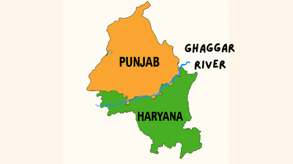
The Ghaggar River , a seasonal river that awakens during the monsoon season, originates in the lower slopes of the Himalayas near the Saharan area in the Sirmaur district of Himachal Pradesh. Flowing through the picturesque Pinjore and Morni Hills of Haryana, it carves its way through the rugged terrain, leaving the hills via the Chandigarh Gorge .
As it enters the plains, the Ghaggar meanders through the southern parts of Punjab, passing through districts like Patiala , Sangrur , and Mansa in a south-westerly direction. Beyond this point, the river is known as Harike , which eventually disappears into the sands near Hanumangarh in the Ganganagar district of Rajasthan.
A River Steeped in Mystery
The Ghaggar River has long fascinated historians, geologists, and archaeologists due to its unique characteristics. The riverbed, which spans an impressive width of 5 to 8 kilometers in some areas, is composed of loamy soil, suggesting that it once carried vast quantities of water. This has led to the belief that in ancient times, the Ghaggar was part of a much larger and perennial river system.
It is widely hypothesized that the Ghaggar was once fed by two mighty rivers: the Satluj from the north-east and the Yamuna from the east. However, due to significant physiographic, climatic, and tectonic changes over millennia, the course of these rivers shifted. The Satluj moved north-westward, while the Yamuna turned south-eastward, leaving the Ghaggar deprived of its primary sources of water. As a result, the once-mighty river transformed into a seasonal stream, flowing only during the monsoon months.
The Lost Saraswati Connection
The Ghaggar River is often identified with the legendary Saraswati River , mentioned in ancient Indian texts such as the Rigveda . Described as a sacred and life-sustaining river in Vedic literature, the Saraswati is believed to have been a cradle of early Indian civilization. Archaeological findings along the Ghaggar’s course, including remnants of ancient settlements and artifacts, lend credence to the theory that this river may indeed be the defunct Saraswati.
The drying up of the Ghaggar is thought to have played a pivotal role in the decline of the Indus Valley Civilization , many of whose sites are located along its banks. Cities like Kalibangan and Banawali thrived on the fertile lands nourished by the river, but as its waters receded, these civilizations gradually faded into history.
Significance Today
Though the Ghaggar is now a seasonal river, it continues to hold cultural and historical significance. During the monsoon, it provides water for agriculture in parts of Punjab, Haryana, and Rajasthan. However, its erratic flow and dependence on rainfall make it less reliable compared to perennial rivers.
Efforts have been made to revive the river and harness its potential through water conservation projects. These initiatives aim to recharge groundwater levels and restore ecological balance in the region.
Legacy of the Ghaggar
The Ghaggar River is more than just a seasonal waterway; it is a living testament to the dynamic interplay of nature and human civilization. Its story is one of transformation—from a mighty river that sustained ancient cultures to a quiet stream that whispers tales of a bygone era.
For those who walk along its banks or study its history, the Ghaggar offers a profound connection to India’s rich past. It reminds us of the impermanence of natural systems and the resilience of human communities that adapt to changing landscapes. Whether viewed as the lost Saraswati or simply as a river shaped by time, the Ghaggar continues to inspire awe and curiosity, inviting us to explore its mysteries and preserve its legacy for future generations.
The Rivers of Punjab – Lifelines of Heritage and Prosperity
The Rivers of Punjab , often referred to as the “Land of Five Rivers,” are the lifeblood of this historically and culturally rich region. These rivers—Satluj, Beas, Ravi, Chenab, and Jhelum—along with the seasonal Ghaggar, have shaped the geography, economy, and identity of Punjab for millennia. From their origins in the majestic Himalayas to their confluence in the fertile plains, these waterways tell a story of resilience, transformation, and interconnectedness.
The perennial rivers like Satluj, Beas, and Ravi sustain Punjab’s agricultural prosperity, power its industries through hydroelectric projects, and support thriving ecosystems. Meanwhile, the seasonal Ghaggar River , believed to be the ancient Saraswati, connects the region to its Vedic past, offering a glimpse into the rise and fall of ancient civilizations.
These rivers of Punjab are not just natural entities but symbols of unity, cultural heritage, and human ingenuity. They have witnessed the ebb and flow of empires, nourished golden fields, and inspired art, literature, and spirituality. Today, these rivers of Punjab continue to play a pivotal role in shaping Punjab’s destiny while reminding us of the delicate harmony between humanity and nature.
In essence, the Rivers of Punjab are more than geographical features—they are timeless threads weaving together the past, present, and future of this vibrant land.
Frequently Asked Questions (FAQs) About the Rivers of Punjab
Q1. What are the five rivers of Punjab?
The five rivers of Punjab are the Satluj , Beas , Ravi , Chenab , and Jhelum . These rivers have historically defined the region, giving Punjab its name, which means “Land of Five Rivers.” After the partition of India in 1947, the rivers Satluj, Beas, and Ravi remained in India, while the Chenab and Jhelum now flow through Pakistan.
Q2. Why is Punjab called the “Land of Five Rivers”?
Punjab is called the “Land of Five Rivers” because it is geographically and culturally shaped by the five major rivers—Satluj, Beas, Ravi, Chenab, and Jhelum. These rivers have nourished the region’s fertile plains, supported agriculture, and sustained civilizations for thousands of years.
Q3. What is the origin of the Satluj River?
The Satluj River originates from Rakas Lake , near the sacred Mansarovar Lake in Tibet, at an altitude of 4,555 meters above sea level. It is known as Langchen Khambab in Tibet, meaning “River of Glaciers.”
Q4. What is the significance of the Bhakra-Nangal Dam?
The Bhakra-Nangal Dam, built on the Satluj River, is one of the largest gravity dams in the world. It provides irrigation water and generates hydroelectric power for Punjab and neighboring states.
Q5. Which river is known as the “Red River of Punjab”?
The Satluj River is often referred to as the “Red River of Punjab” due to the reddish hue of its silt-laden waters during the monsoon season. This poetic title reflects the river’s raw beauty and significance.
Q6. Where does the Beas River originate?
The Beas River originates from Beas Kund , near the Rohtang Pass in the Kullu Hills of Himachal Pradesh, at an elevation of 4,000 meters above sea level. It flows through picturesque valleys like Kullu and Kangra before entering Punjab.
Q7. What is the significance of the Pong Dam on the Beas River?
The Pong Dam , also known as the Maharana Pratap Sagar , is a multipurpose dam constructed on the Beas River between 1961 and 1975. It serves as a vital source of hydroelectric power and irrigation, supporting Punjab’s agricultural prosperity and providing water to millions.
Q8. Where does the Ravi River originate?
The Ravi River originates from the western slopes of the Rohtang Pass in the Kullu Hills of Himachal Pradesh, at an altitude of 4,100 meters above sea level. It flows through the Chamba Valley and enters Punjab near Chaundh Village.
Q9. What are the major dams on the Ravi River?
The two major dams on the Ravi River are:
Ranjit Sagar Dam (Thein Dam) : Located near Pathankot, it supports irrigation and generates hydroelectric power.
Chamera Dam : Situated in the Chamba Valley of Himachal Pradesh, it contributes significantly to hydroelectric power generation.
Q10. What is the historical significance of the Ghaggar River?
The Ghaggar River is believed to be the ancient Saraswati River mentioned in Vedic texts like the Rigveda. Archaeological findings suggest that it once carried vast quantities of water and supported the Indus Valley Civilization. Over time, due to tectonic and climatic changes, it transformed into a seasonal river.

